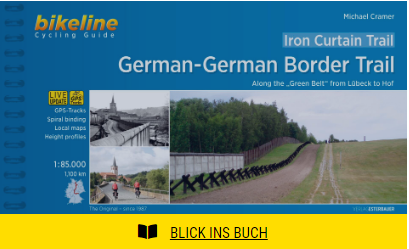
German- German Border Trail Bikeline Fietsgids
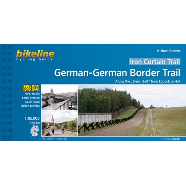
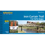
Iron Curtain Trail 3: German - German Border Trail Bikeline Fietsgids
-
Lang leve de specialist
Alles wat wij doen en verkopen is fietsvakantie-gerelateerd.
-
Fietsen maakt het hoofd leeg en het hart open
Even niet presteren. Beginnen, en de rest komt vanzelf op je af.
-
Eenvoudig gelukkig is gelukkig eenvoudig
Misschien wel de grootste rijkdom van een fietsvakantie.
Productomschrijving
Video Product
Productomschrijving
Iron Curtain Trail 3: German- German Border Trail: 1100 km
Druk 2019 - Engelstalig
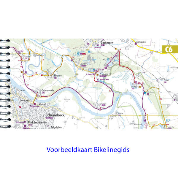
De fietsgids
De Bikelineboekjes zijn al jaren zeer geliefd bij onze klanten. En terecht! Het is een zeer handzame ringband met zeer gedetailleerde fietskaarten en indien nodig stadsplattegronden waar de fietsroute ook op ingetekend is. Geen gezoek in de grote stad dus. Ook zijn, indien relevant, diverse hoogtegrafieken aanwezig.
De kaartjes zijn gemaakt van scheur- watervast papier. Hiernaast vindt u zeer uitgebreide toeristische info en alle overnachtingsadressen met nauwkeurige prijsindicatie. De adressen staan op volgorde van de route. Ook campings zijn terug te vinden in de lijst. De route is twee kanten op bewegwijzerd. De meeste fietsers combineren deze bewegwijzering met de heldere kaartjes. Her en der zijn er altijd bordjes weg natuurlijk. De fietsgids past bijzonder mooi in de Ortlieb-kaarthoes.
Gps-track
Voorin deze fietsgids staat een code of link waarmee u op de site van Esterbauer heel eenvoudig de GPS-track kan opvragen.
Wijzigingen
Klik op de button hieronder voor de laatste wijzigingen op de site van de uitgever Esterbauer.
Digitaal bladeren in Bikelinegids. Incl.routeoverzicht (pag.1) en hoogteprofiel:
Info, zwaarte en wegkwaliteit: Alle info op een rij:
Engelstalige beschrijving van de route van de site van Bikeline
To live, breathe and experience history in its purest form – that is the goal of the „European Iron Curtain trail”. From the Barents Sea to the Black Sea, this guide traces the history of the Cold War and takes you along the Western border of the old Warsaw Pact countries across Europe. The route does not just embody European culture, history and sustainable tourism, but also provides cyclists who are interested in history with some spectacularly beautiful and varied landscapes and unique habitats in the European Green Belt, which one is sure to find along the border strip. This volume describes the 1,100-kilometre-long part from Lübeck to Hof, where the borders of Saxony, Bavaria and the Czech Republic meet.
The German-German Border Trail
Not only was Berlin divided, so was all of Germany, for decades. It was therefore necessary to preserve the memory of this along the 1,400 km former border. For that reason the national caucuses of the SPD and the Greens proposed on June 30th, 2004 to transform the former “death strip” along the German border into a “living space”. According to the proposal it would be developed for “sof” tourism“, and be a part of a European Green Belt along the former “Iron Curtain”. The Bundestag voted for this unanimously in December 2004. The present book describes the German-German Border Trail in the “Green Belt”, which approaches 150 natural parks, 150 flora-and-fauna areas, three biosphere reservations Schaalsee, Elbaue and the Rhoen and the National Park of the Harz Mountains. It takes one from the Baltic to the Czech border, passes countless rivers, streams, and lakes and takes us through the higher parts of the Harz mountains and through the forests of Thuringia. We pass many monuments and border land museums and also several of the remaining observation towers. Of course there are many alternatives to taking this path. One can remain on the western or on the eastern side, one can stay close to the border or bike some distance from it, one can take the former control road with its perforated roadway or one can choose asphalt. The route in this book stays as close as possible to the former border, but stays on as comfortable a path as possible, avoids heavily travelled roads, integrates many historical monuments, crosses the former border at several points and informs about many monuments and museums.
This book would not have been possible without the support of other persons and institutions. Therefore I would like to thank sincerely for its generous support the “Foundation Understanding the SED-Dictatorship”; it opened its archives and permitted the use of many historic photos. I would also like to thank Marco Bertram, who not only did the entire 1.400 km along the German-German border by foot in 2003 and made countless photos along the route, but who also helped, two years later, to find the appropriate bicycle route, the route I chose finally in the summer of 2006. Help also came from Wilhelm Beese, Korbinian Frenzel, Jule Henkel, Nicoline Henkel, Gaby Kaczmierzyk, Willi Pieczk, Erdmute Safranski and – for the translation – from Michael Cullen and Reinhard Schramm.
Thanks too to Klaus Buchin, who was one of the first to discover the valuable natural treasures along the former border trace and who also worked hard to get them protected. In joint work with the German Association for the Environment and Protection of Nature (BUND) he was able to achieve that the “Green Belt” was discovered as a biotope, secured by the Federal states and accepted by the Bundestag unanimously in 2004. In his two-volume book “Randwanderweg” (Bicycle Wander Route) – unfortunately out of print – he was the first to describe the path and to identify the remnants of the Iron Curtain in Germany. For their commitment, Hildegard and Klaus Buchin were given the Environmental Award “Golden Nature”, on August 26th, 2001 by the Federal Minister for the Environment, Jürgen Trittin. Many of Buchin’s tips were incorporated in this book.
Also helpful was the book by Maren Ullrich: “Geteilte Ansichte” (Shared Views), in which almost 300 monuements and “Lieux de memoire” along the 1,400 km German-German border are investigated. The author puts the monuments, which are always a mirror of the circumstances at the time of their erection, into the context of the main political events. I would also like to thank Jürgen Ritter who took countless photos on his wanderings along the internal border in 1984, and 22 years later documented the changes of the death strip into a living space from the same perspective. The photos provided by him are a valuable contribution to this book.
The Trail as a living history lesson
The German-German Border Trail is a charming combination of history workshop and bicycle tourism, of vacation and culture. It makes clear that the former inhuman border strip between East and West-Germany, the so-called ‘death strip’ is now a large group of biotopes and a living ecological monument, which, in its unique way, reminds us of how Germany was divided and how the division was overcome.
The 1,400 km long Trail is divided into 37 chapters, or stages, the start and finish of each are located, wherever possible, at a railway station. In Germany it is permitted to take bicycles on all regional trains and on certain national trains.
Hoofdkenmerken op een rij
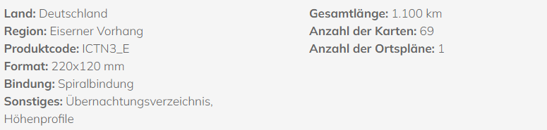
| Schaal | 1:85000 |
|---|---|
| Taal | Engels |
| Uitgever | Bikeline |
| Jaar van uitgave | 2019 |
| Artikelnummer | 467353 |
| EAN / ISBN | 9783850007900 |