Het is erg druk, mogelijk duurt het ietsje langer voordat uw pakje ingepakt is dan u van ons gewend bent.
- Voor 15:30 besteld, zelfde werkdag weg
- Verzending € 3,50 of € 5,95 (NL)
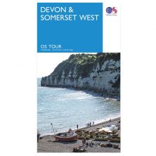
Fietskaart Exmoor North Devon
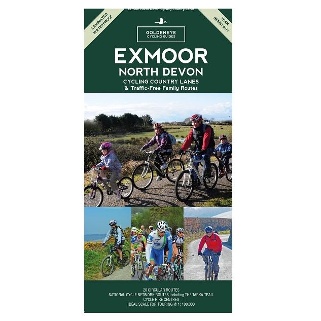
Exmoor North Devon
Speciale prijs
€ 7,74
Normale prijs
€ 12,90
-
Lang leve de specialist
Alles wat wij doen en verkopen is fietsvakantie-gerelateerd.
-
Fietsen maakt het hoofd leeg en het hart open
Even niet presteren. Beginnen, en de rest komt vanzelf op je af.
-
Eenvoudig gelukkig is gelukkig eenvoudig
Misschien wel de grootste rijkdom van een fietsvakantie.
Productomschrijving
Productomschrijving
Goldeneye Fietskaart Exmoor North Devon
Geplastificeerde fietskaarten met 20 dagtochten en het National Cycle Network ingetekend. Bevat fietsverhuuradressen, index en campings. Engelstalig.
Our maps are double-sided, printed on an A2 sheet with a concertina fold. This allows for easy folding and folding, and an ease of access to the mapping. The material is rain and tear-resistant. Our early maps were designed at the scale of 2 miles to 1 inch/1:126,720. The later designs along with digitalisation are 1: 100,000. We were encouraged by the Cycle Touring Club to convert our cartography toward the cycle market (to replace the out-of-print Bartholomew series). As time and the series progressed we have added more data: The National Cycle Network routes, Regional Routes, and Traffic-Free Family Routes, as and when they are developed. These routes are in addition to the Circular Routes Goldeneye Commissioned at the outset of our publishing schedule. We are also adding to new editions; bike shops, cycle hire, and tea rooms, along with the tourist attractions already featured. Our plan is to make available digital versions for cell phones and tablets and to update, on an annual basis.
National Cycle Network (NCN)
This is a linked series of traffic-free paths and traffic-calmed roads being developed across the UK linking town centres and the countryside. The so-named route numbers do not always join up as the overall planned route has not yet been completed and sometimes they overlap with other routes. sustrans.org.uk
This Map covers the Exmoor National Park and North Devon; an area with a wide variety of coastal and inland scenery, much historic, architectural and leisure interests. The Exmoor National Park is largely in Somerset, with a small portion lying in Devon. At times the climate is harsh with mist, cloud and rain, and is reminiscent of Scotland. When the skies clear, the wild, wide beauty is unsurpassed. The landscape is undulating, full of rolling hills, marshland, bracken, heather and gorse, and divided by swift flowing streams which cut through the steep-sided valleys, known as combes. The rolling moorland provides splendid views seawards across the Bristol Channel to Wales. In places the coast is crowned with high cliffs falling precipitously to the sea. The Exmoor sheep and wild ponies are seen everywhere, as can be found buzzard and raven. The roaming red deer is rarely seen close to, they feed at night and by day lie hidden in the woods or bracken.
North Devon is a rural landscape of small villages, rich pastures, secluded coves and long sandy beaches popular with the surfing fraternity. The two ancient ports of Barnstaple and Bideford have grown beside the wide estuary of the Taw and Torridge rivers. Stretching southwards from these ports is the gentle pastoral countryside known as 'The Land of the Two Rivers' so vividly brought to life in the works of Henry Williamson. The warm equable climate, together with the nature of the countryside provides excellent recreational opportunities, particularly for the cyclist and mountain biker, walker, horseman, fisherman and surfer. The area also contains a sufficient variety of cultural and urban interests to satisfy all tastes.
So, if you seek quiet country lanes, river valleys and routes along flat ridges affording spectacular sea views that swoop down to picturesque villages with tearooms awash with clotted cream, and hospitable country inns. Look no more. It is all here. Happy Cycling, Al Churcher
Recommended Routes/Trails
National Cycle Network (NCN) & Regional Routes
This comprises three Regional Routes (RR) and is bounded by the National Cycle Network Route (NCN) 3 to the south, and the NCN 27 to the west.
1. Regional Route 56: This is a link between NCN 3 at Bratton Fleming and RR 51 at Berrynarbor. (J4)
2. RR 51: Links coastal towns and villages; Ilfracombe - Combe Martin – Trentishoe – Martinhoe – Lynmouth – Malmsmead. (G2)
3. RR 59: Links Exmoor with the coast; Kinsford Gate – Simonsbath – Lynmouth. (K4)
4. NCN 27 Devon Coast to Coast: Ilfracombe – Mortehoe – Woolacombe – Croyde – Upcott – Braunton – Barnstaple, then onto the NCN 27 towards Dartmoor and Plymouth. (F2)
5. NCN 3 The West Country Way; Bristol – Padstow via Exmoor, Barnstaple, Instow (Tarka Trail to Petrockstow). (G9)
Traffic-Free Family Routes/Trails
1. The Tarka Cycle Trail (part of NCN 3 & 27) runs on tarmac from Braunton – Barnstaple, then beside the Taw Estuary to Instow, up beside the River Torridge to the Puffing Billy pub below Torrington. Crossing the river to Watergate Bridge, the trails joins a bridlepath and is cycleable on a hybrid, touring and folding bike all the way to Meeth. Excellent café at Yard - Railway summit (F8). Distance 32 miles/51kms - all traffic-free. (F4)
2. Ilfracombe to Willingcott Cross. Easy family trail along former railway line with waymarked links to Woolacombe. Distance 3 miles/5kms. (F2)
3. Grand Western Canal (NCN 3). Quiet, family cycling trail along canal path, to and from Tiverton. Distance 8 miles/13kms. (P8)
4. Willand to Tiverton Parkway. With link to NCN 3, this is a flat, traffic-free path. Also links up with the Grand Western Canal at Sampford Peverell. Distance 3 miles/5kms. (R8)
Hoofdkenmerken op een rij
| Schaal | 1:100.000 |
|---|---|
| Taal | Engels |
| Uitgever | Goldeneye |
| Jaar van uitgave | 2017 |
| Artikelnummer | 002586 |
| EAN / ISBN | 9781859652244 |
Reviews
Schrijf uw eigen review
Vergelijkbare artikelen